Large-scale terrain data generation TIN processing flow
Operating procedures
1、All data is divided into task areas according to the projection zone (each task area should not cross the zone), and manually divided into multiple task areas, which can be processed by multiple machines at the same time.
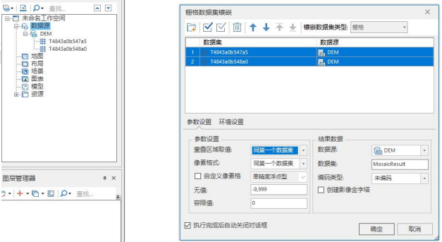
2、Import tif/asc/.. data according to the task area. Use the desktop to import all terrain data in the task area, and then perform mosaic processing.
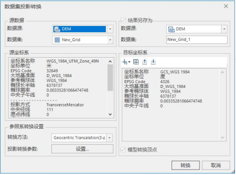
3、Coordinate transformation is performed on the data imported in each task area and converted into a geographic coordinate system.
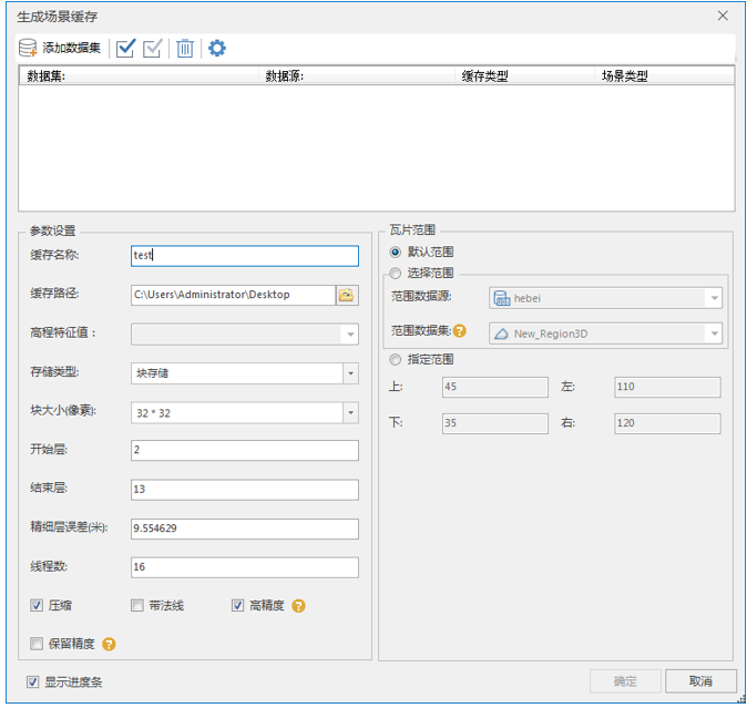
4、TINs are generated separately for each task area. Similarly, if you are pursuing higher loading performance and experience, it is recommended to choose block storage as the storage type.
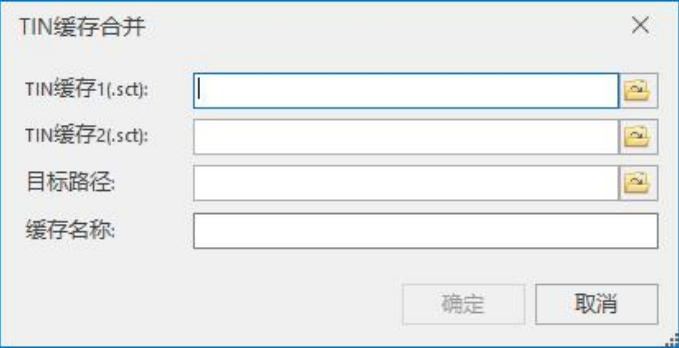
5、Merge the generated TIN terrain in pairs (3D data-TIN tool-merge TIN cache). If the two terrains overlap, the high-precision terrain is on top (the position of TIN cache 1). If it is just a splicing operation, it can be ignored. order.
6、Batch request loading in SuperMap iClient3D for WebGL. If it is a version before 10.1, the TIN terrain needs to generate a compact storage type, and you can also experience the loading effect of the 10.1 version block storage by enabling batch requests in SuperMap iClient3D for WebGL.
There is no need to add packingRequest:1 to the block storage data.
        var provider_terrain=new SuperMap3D.SuperMapTerrainProvider({
                url : url,
                isSct : true,//地形服务源自SuperMap iServer 发布时需设置isSct为true
                packingRequest:1//批量请求
                });
Precautions:
- ①If you need to perform operations such as slope aspect analysis on the TIN cache, when generating the TIN cache, be sure to check the With normal check box.
- ②If you need to extract 3D data from the TIN cache, etc., when generating the TIN cache, be sure to check the High Precision check box.
- ③If the accuracy of the DEM data is particularly high, such as an accuracy error of 0.1 meters, you can check the Preserve Accuracy check box when generating the TIN cache.